The Isle of Mull’s history is long and varied, with the island believed to have been inhabited since around the end of the last Ice Age. In this guide to island history, you’ll step back in time to castles and clan systems, to crannogs and brochs, to periods of interesting natural history and to times of great hardship during the Clearances. Journey through the centuries and find what awaits your discovery when you visit the island of Mull.
Isle of Mull History
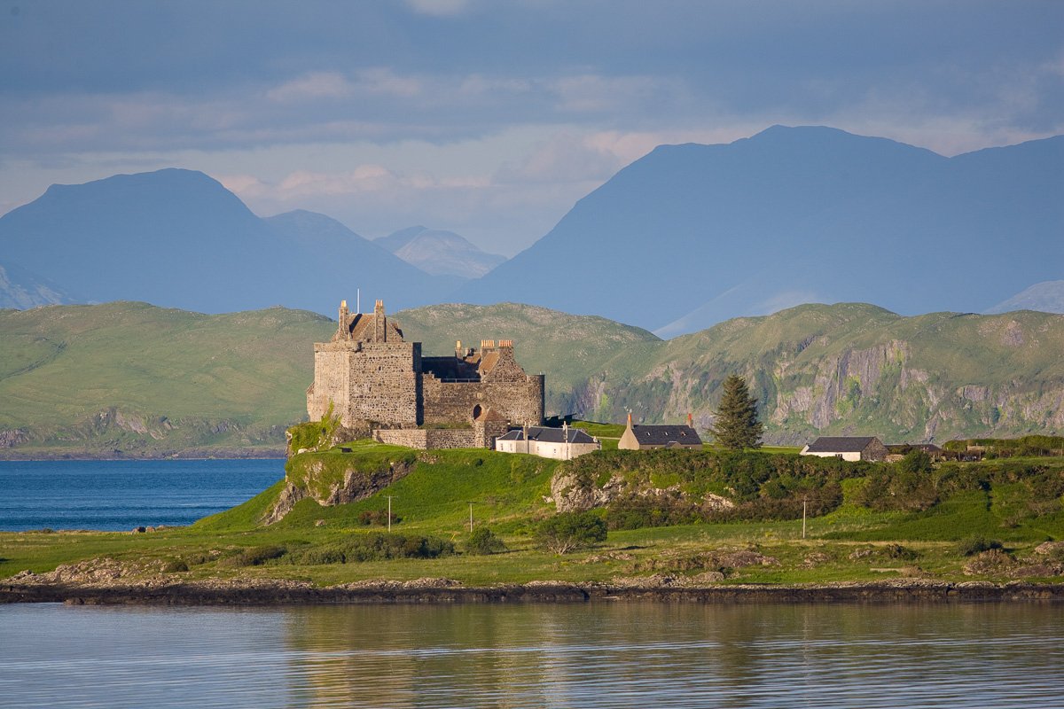
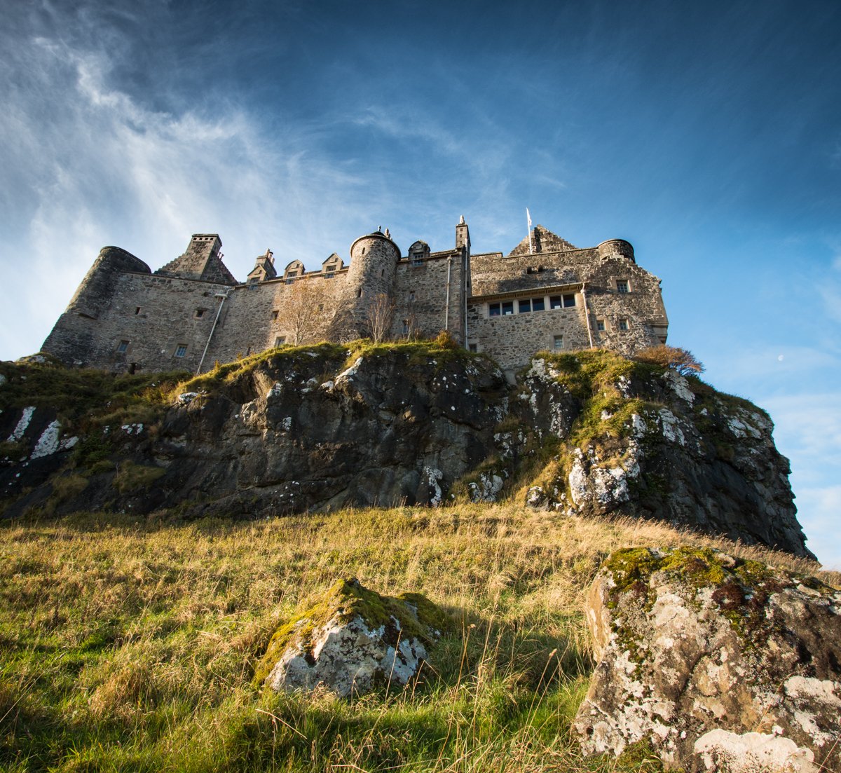
Castles
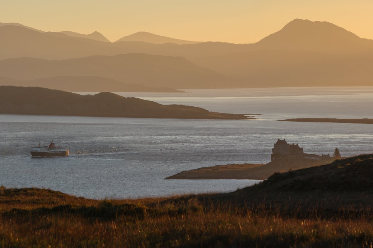
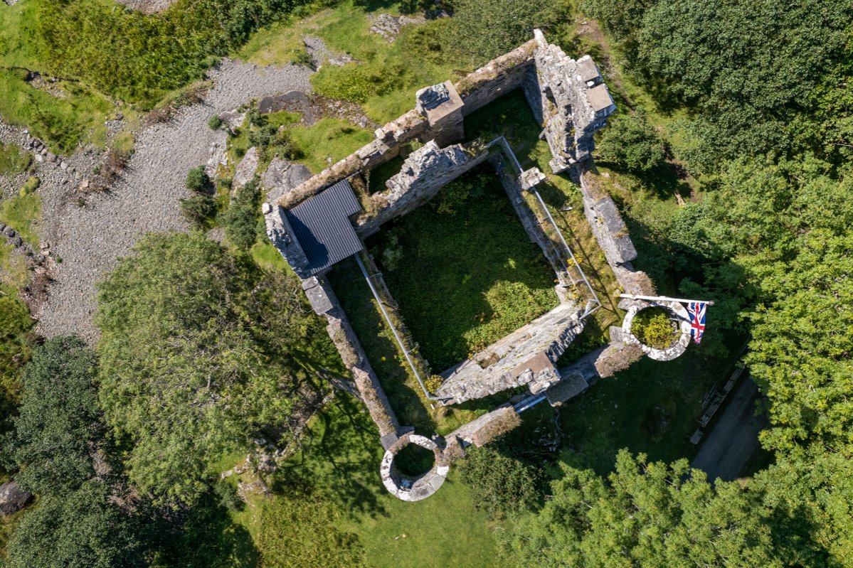
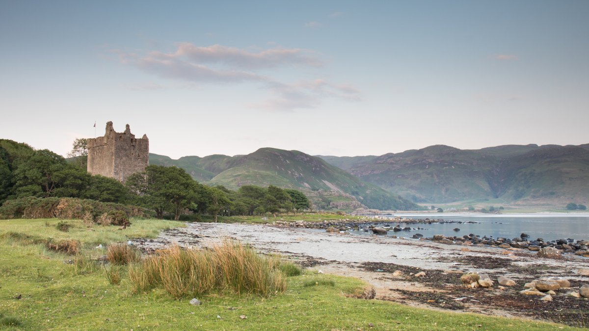
For an island with a present-day population of around 3,000, Mull certainly punches above its weight in density of castles, speaking to its strategically important position in years gone by, as well as the dominance of the clan system across the Highlands and Islands, with the 13th century Duart Castle remaining the seat of Clan Maclean to this day.
The imposing view of the castle on the clifftop is one of the first glimpses of the island for many visitors arriving on the ferry from Oban and is open to the public for tours in season, but as you venture further afield, there are plenty more castles to come.
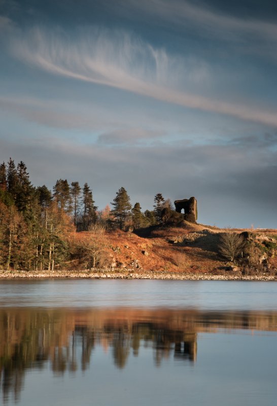
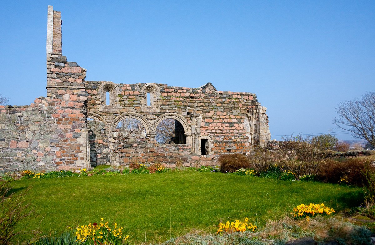
A coastal walk at Lochbuie will bring you to the ruins of Moy Castle right beside the shore, which was built in the mid 15th-century by the first Laird of Lochbuie. Heading east, the 13th century remains of Aros Castle tower above the Aros estuary, once the castle of Clan MacDougall before later falling into the possession of the Lord of the Isles for a time.
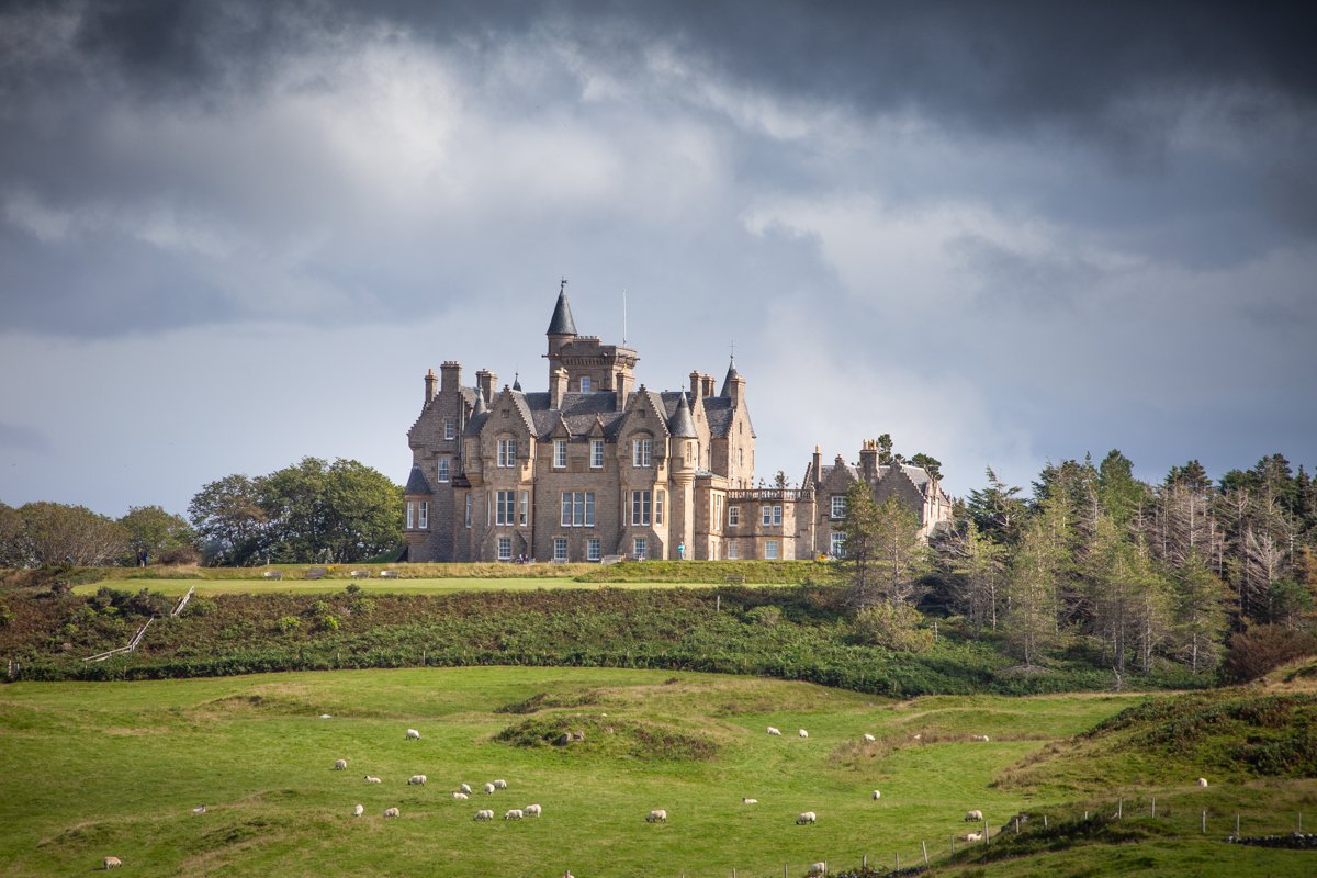
In much better shape is the most impressive, baronial-style, privately owned Glengorm Castle in the island’s north, a short drive from Tobermory. Glengorm Castle dates back to the 19th century and was designed by acclaimed Scottish architects Kinnear and Peddie. Visitors may enjoy excellent views back to the castle on the return from the walk to Dun Ara, itself a site of historical interest, and the bathing pool.
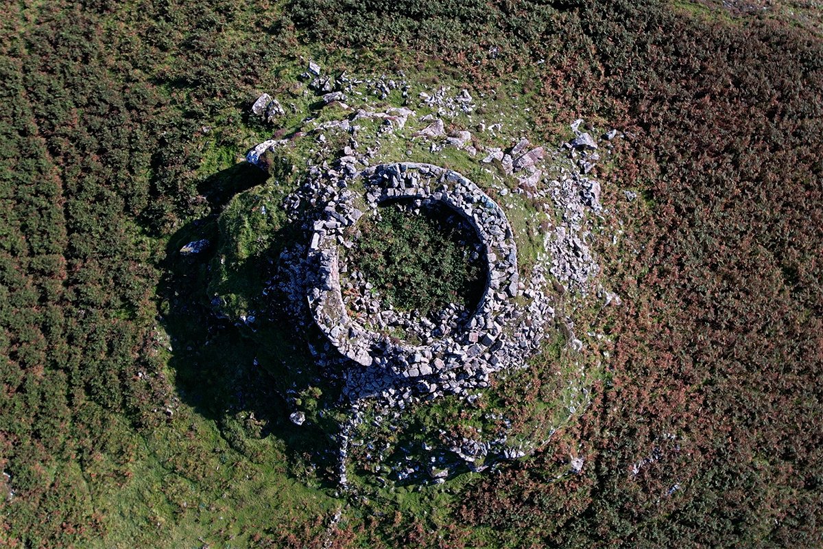
Brochs
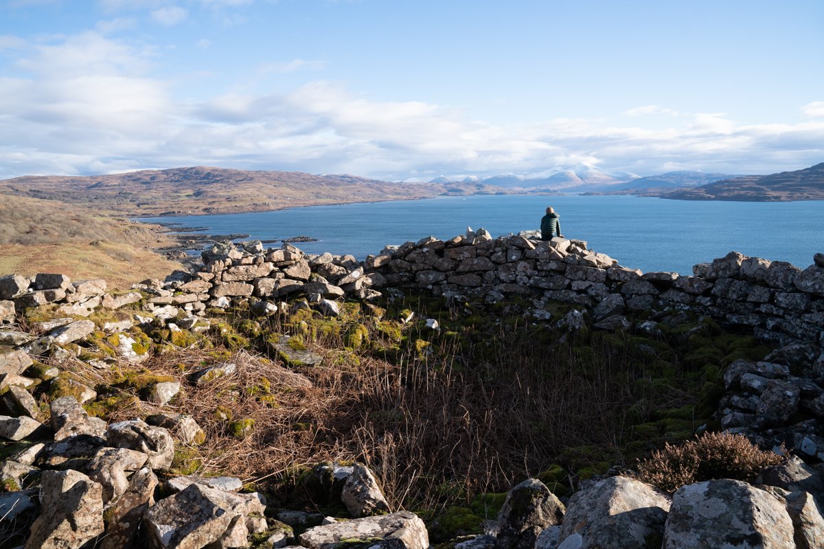
There are several notable Iron Age ruins remaining on Mull, including the Iron Age fort at the summit of Cnoc na Srione to the north west of Salen. But brochs, which also date from this period, adopt a category of their own thanks to their distinctive conical shape and the way of living that they offered.
From the outside, these once impressive structures would have presented themselves as a towering cone formed from thick stone walls that tapered inwards as it climbed higher. It is easy to see how such a seemingly impenetrable structure would be useful in terms of security and defence. Within these impressive frames were several different floors that offered different domestic spaces within.
On Mull, one of the best examples of a broch – although now a ruin – lies along the west coast at Loch Tuath and is named Dun nan Gall, where the remains of the mighty stone wall and indeed, even a stone step, remain visible on the coastline, despite its exposed position to both weather and tide.
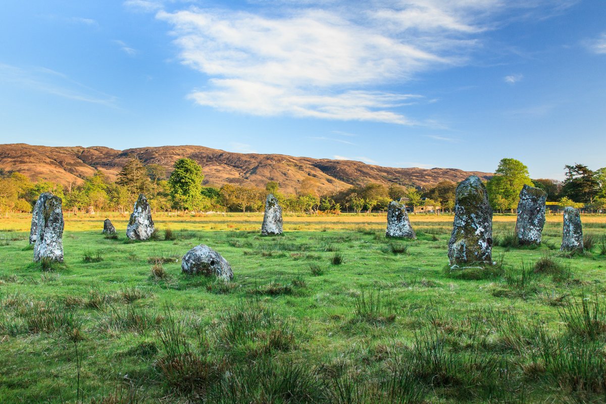
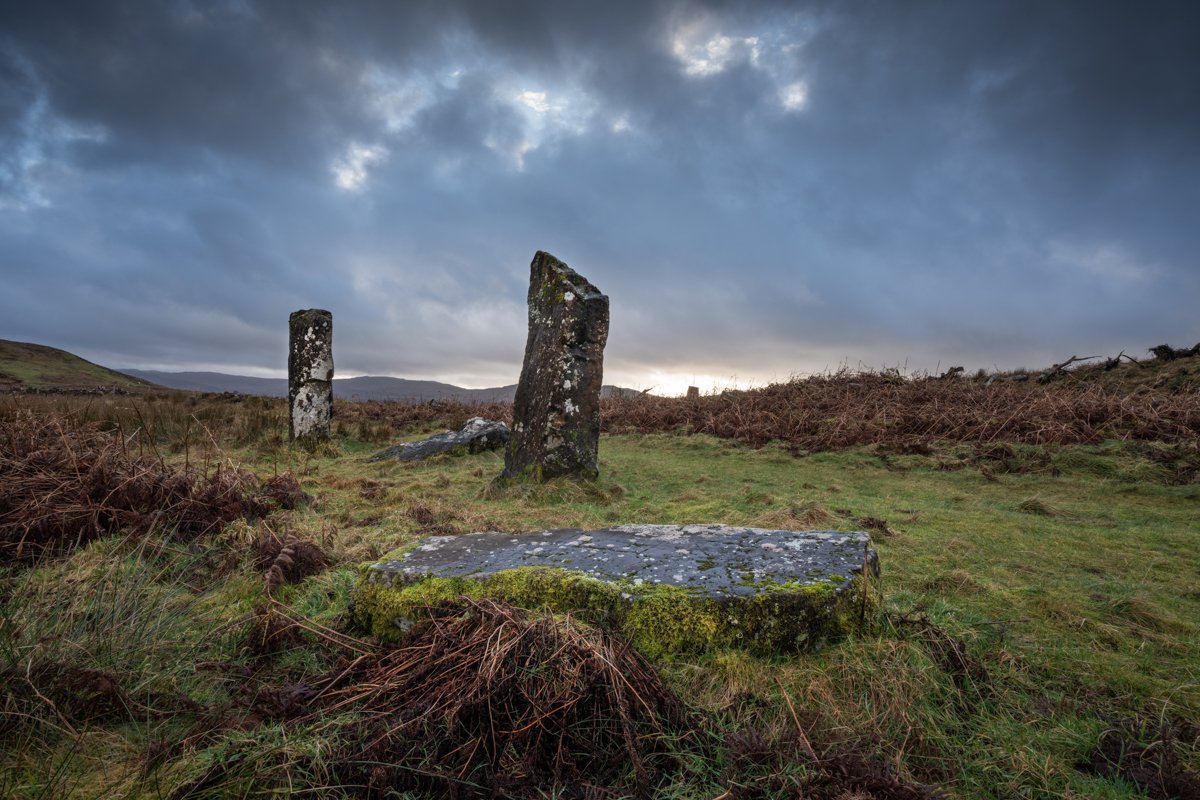
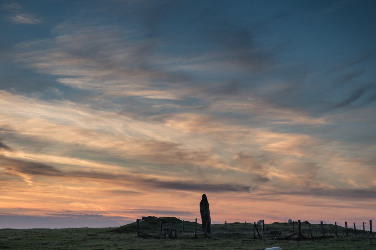
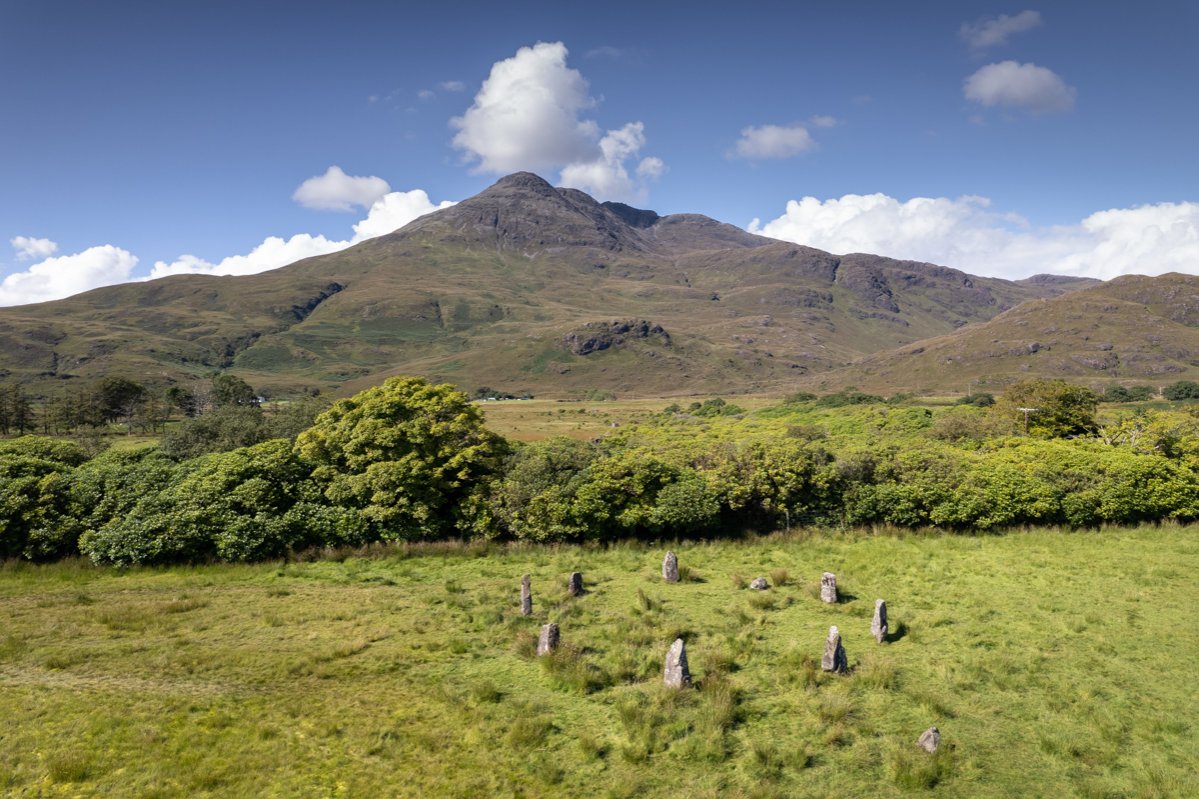
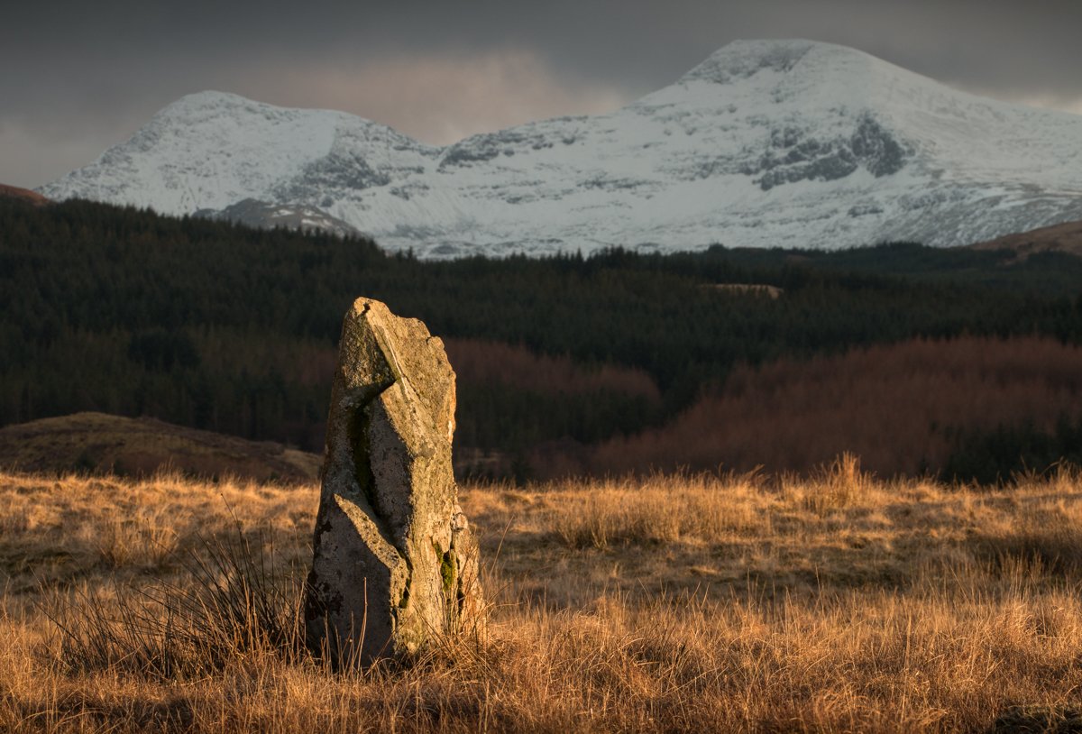
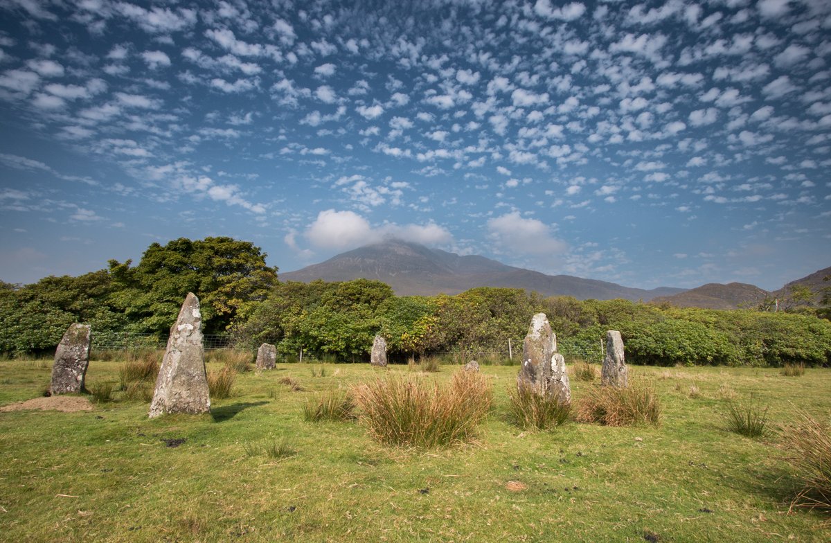
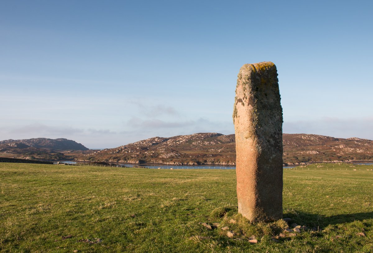
Standing Stones
There are several sites where standing stones remain on the island, whether a single stone, a row, or, as is the case in Lochbuie, the classic stone circle that many picture. To visit the stone circle at Lochbuie, park just before you come into the settlement in the designated area to the left and follow the trail through the moorland fields to reach the circle of granite standing stones, before retracing your steps and continuing on to the coast. This stone circle has been well preserved, with three further monoliths surrounding the circle at varying distances too.
There are also standing stones at Glengorm to the west of the castle, which may be visited from the Dun Ara path, and also in the north of the island a group of five stones at Kilmore, just above the village of Dervaig, and four stones at Quinish, although not all the stones remain standing at these sites. The single stone that holds its towering upright position at Quinish is often referred to as ‘Caliach’, meaning old lady in Gaelic.
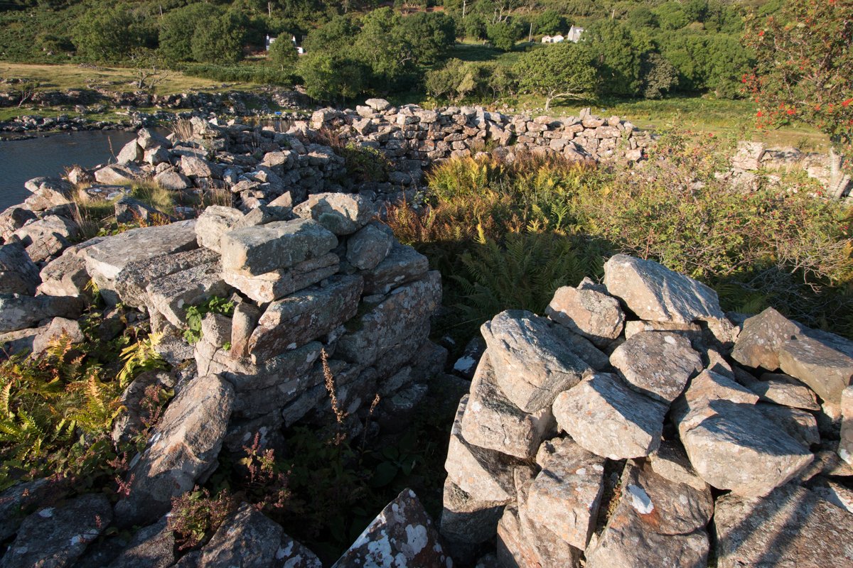
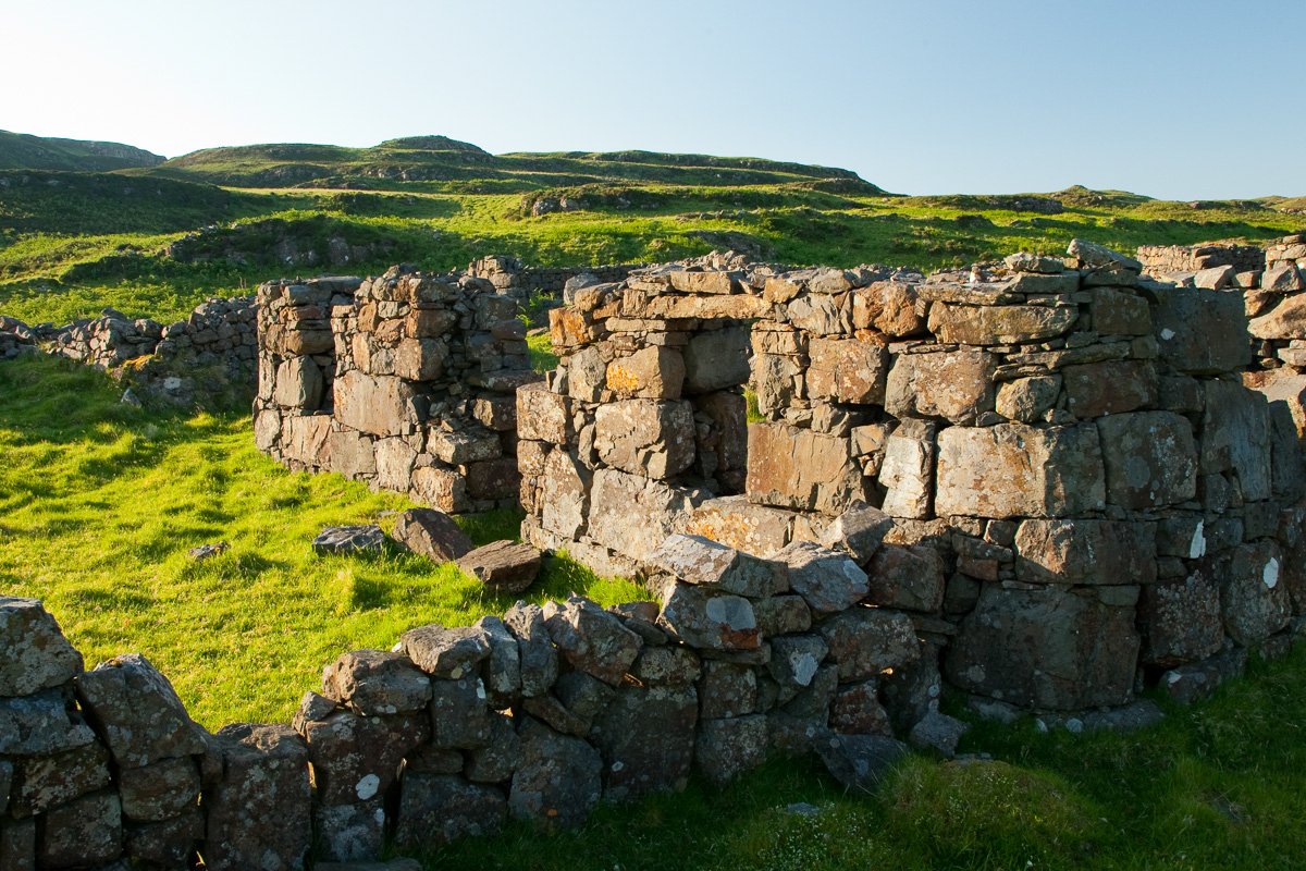
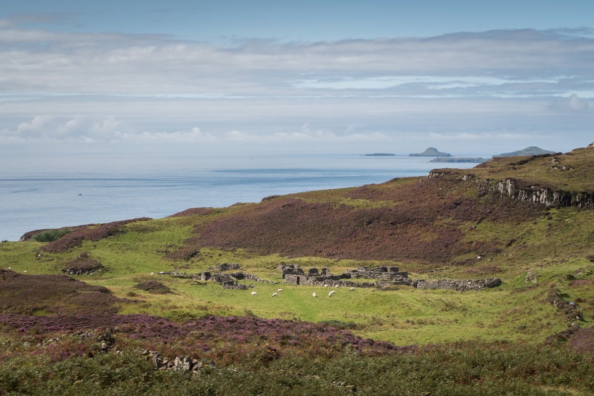
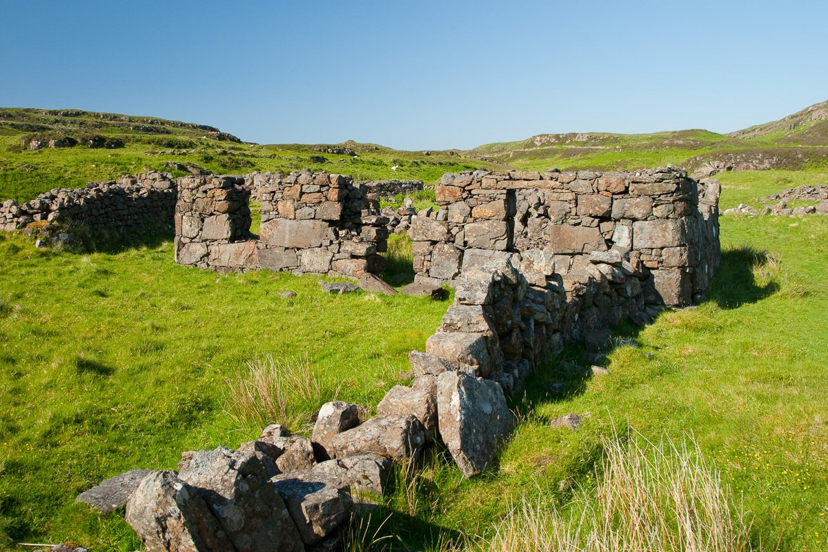
Clearance Villages
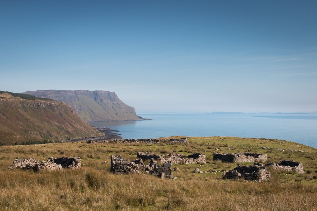
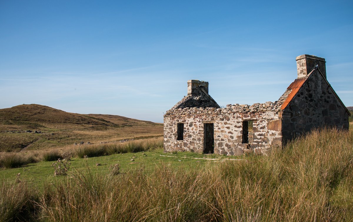
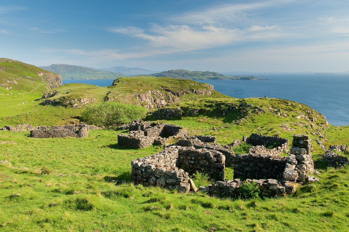
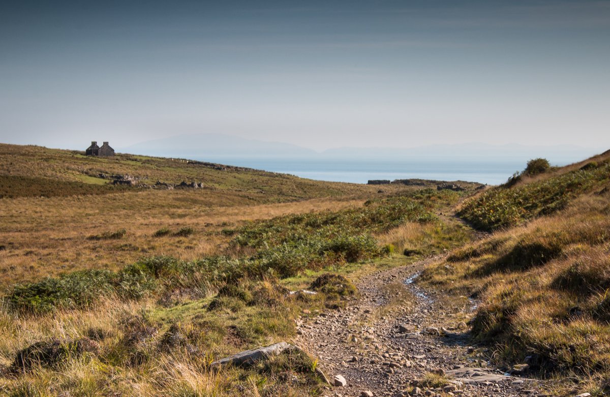
The Highland Clearances are one of the most keenly felt periods in Scottish history, with hundreds of local residents evicted by their landlords across the Highlands and Islands over a period of around 100 years, who sought to put the large estate lands to more profitable agricultural use. Many ruined townships can be seen across Mull dating back to these times, with two of the most accessible at Shiaba on the Ross of Mull and at Caliach Point near Calgary.
Once home to over 350 people, Shiaba can be reached by a coastal track from the road end at Scoor, just south of Bunessan, where the remains of many buildings can still be seen today, including the stone cottage that was once the village shop, a ruined chapel and schoolhouse, as well as remnants of the runrig farming system and water mills along the burn, Allt Cnoc na Fannaige. Beneath Shiaba is the beach, Traigh Bhan, which was one of several used on Mull during the clearances to launch boats that would deliver evicted villagers to new lives across the Atlantic.
It is also possible to embark on an all-day circular walk along the coast past Treshnish, where you can take in beautful wildflowers and stunning views to the Treshnish Isles as you make your way. Rounding the headland, you'll cross a false beach - now a large, flat, grassy area at the foot of cliffs - before approaching a ruined chapel and then the remains of the settlements of Crackaig and Glac Gagairidh. The cluster of cottages still retain many of their exterior walls with clues to where openings once made way for windows and doors and the local schoolhouse is still discernable too.
Natural History
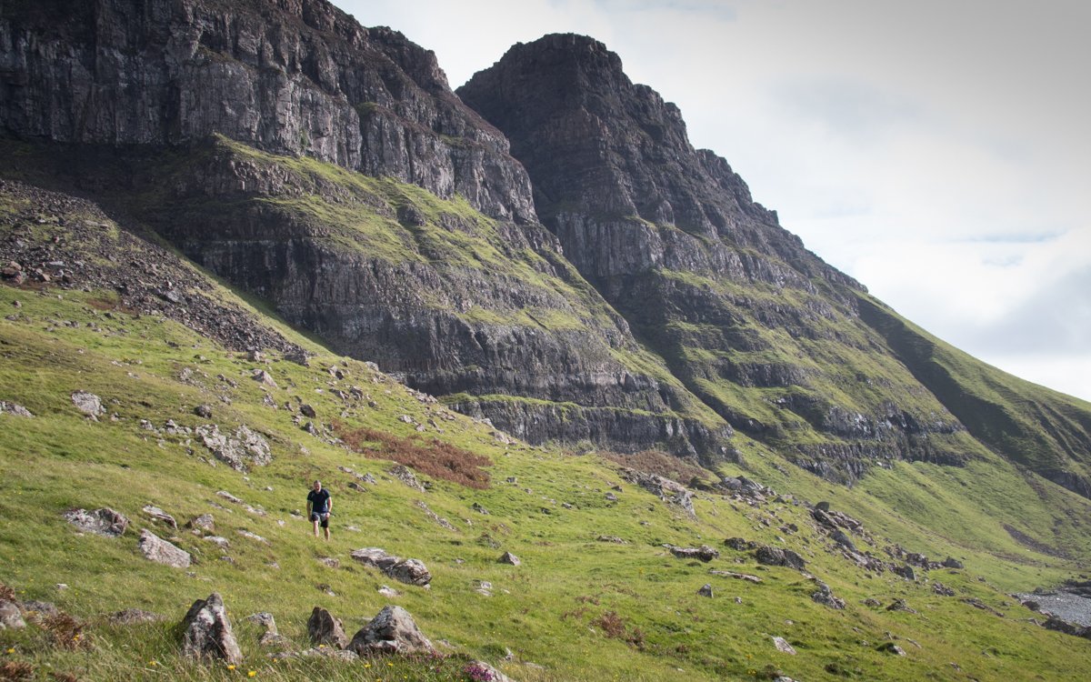
For those keen on their natural history, then Mull has yet more of interest in store. The best known of Mull’s fossils will undoubtedly be the fossilised tree at Burg, on the Ardmeanach peninsula, which is maintained by the National Trust.
A full-day hike will take you to see MacCulloch’s fossil tree and back, and the route map can be found on our Isle of Mull walks page. When the tide allows, those with a head for heights can descend a metal ladder down the rockface to reach the tidal pebble beach below, from which the remains of the fossil tree can be seen in the cliff face, believed to be some 50 million years old.
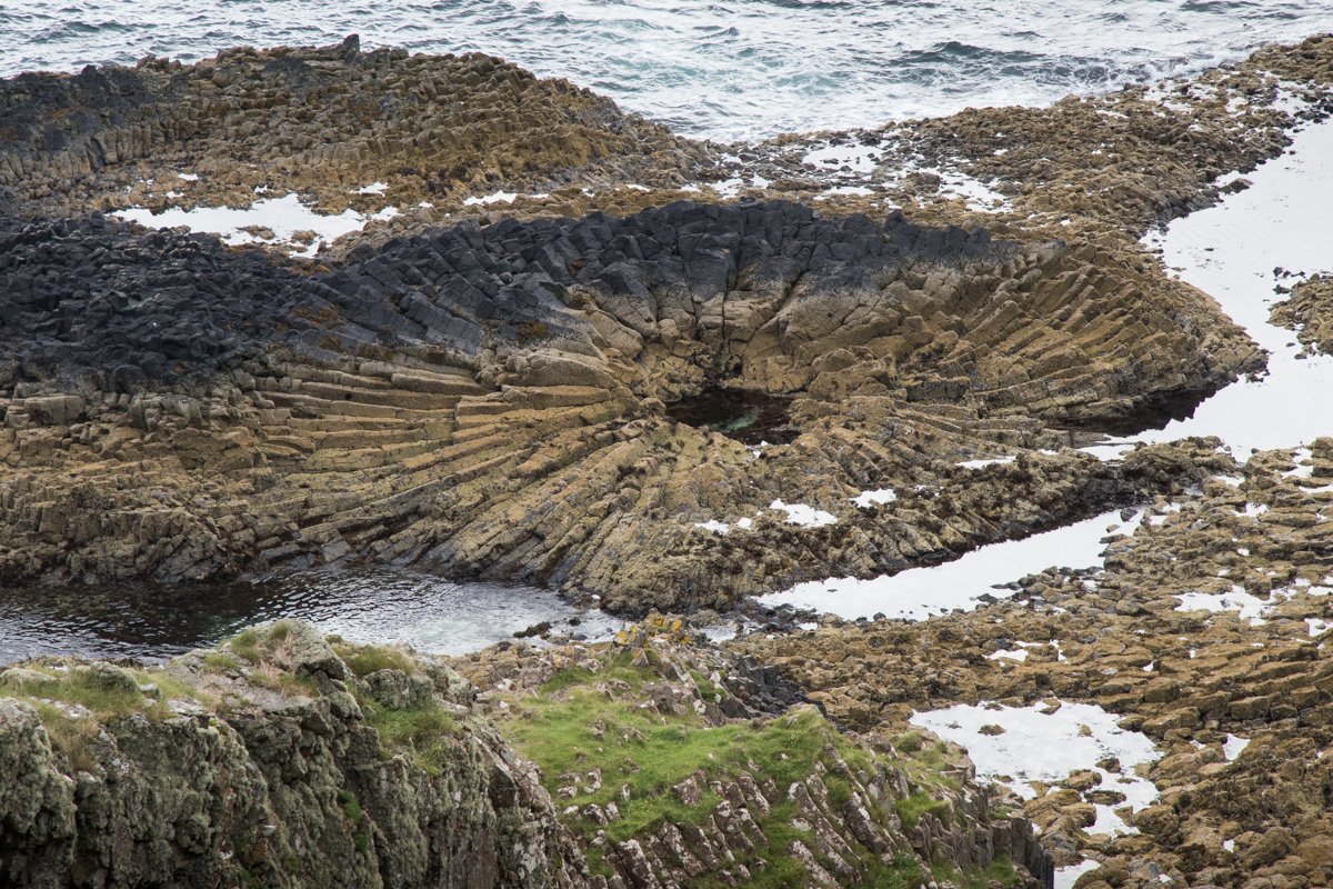
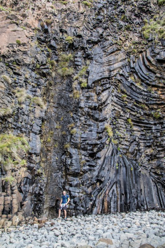
For a lower level excursion, the fossil leaf beds at Ardtun on the Ross of Mull also promise plenty of interest. The path takes you from the village of Bunessan along the shore of Loch na Lathaich and out onto the headland passing Aoineadh Mor, notable for columnar basalt. Then, at the furthest point of the headland, a gully reveals fossilised leaves that once belonged to trees on a prehistoric lake.
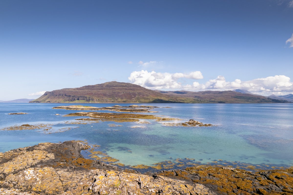
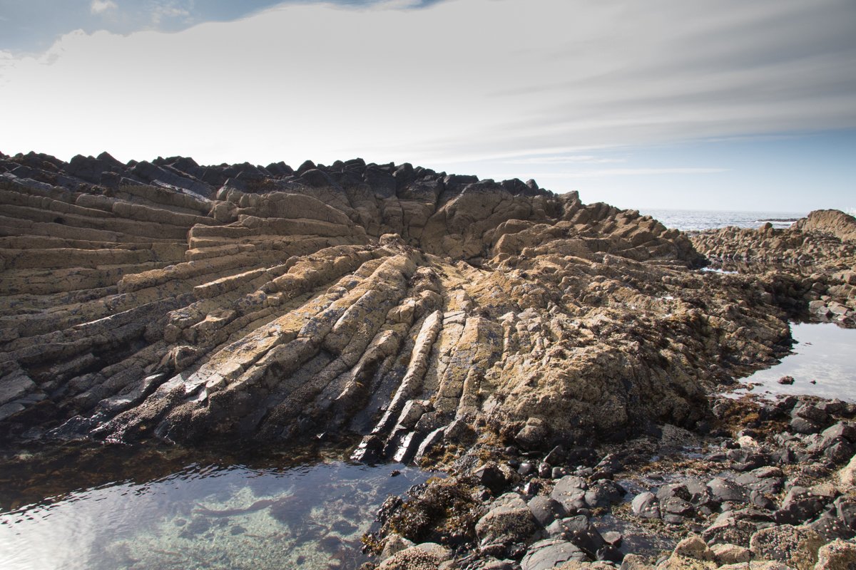
Another natural phenomenon formed from the erosion of the sedimentary rock on the coastline near Carsaig, the Carsaig Arches have long been an attraction to the island's most adventurous visitors. A challenging all-day hike will deliver you to the arches and back, but as you explore this stretch of coastline there's plenty more natural history to discover.
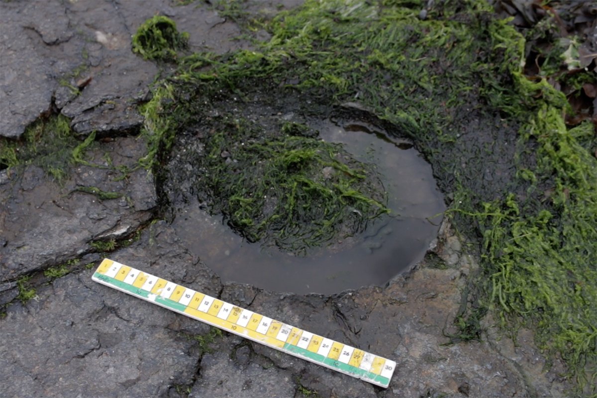
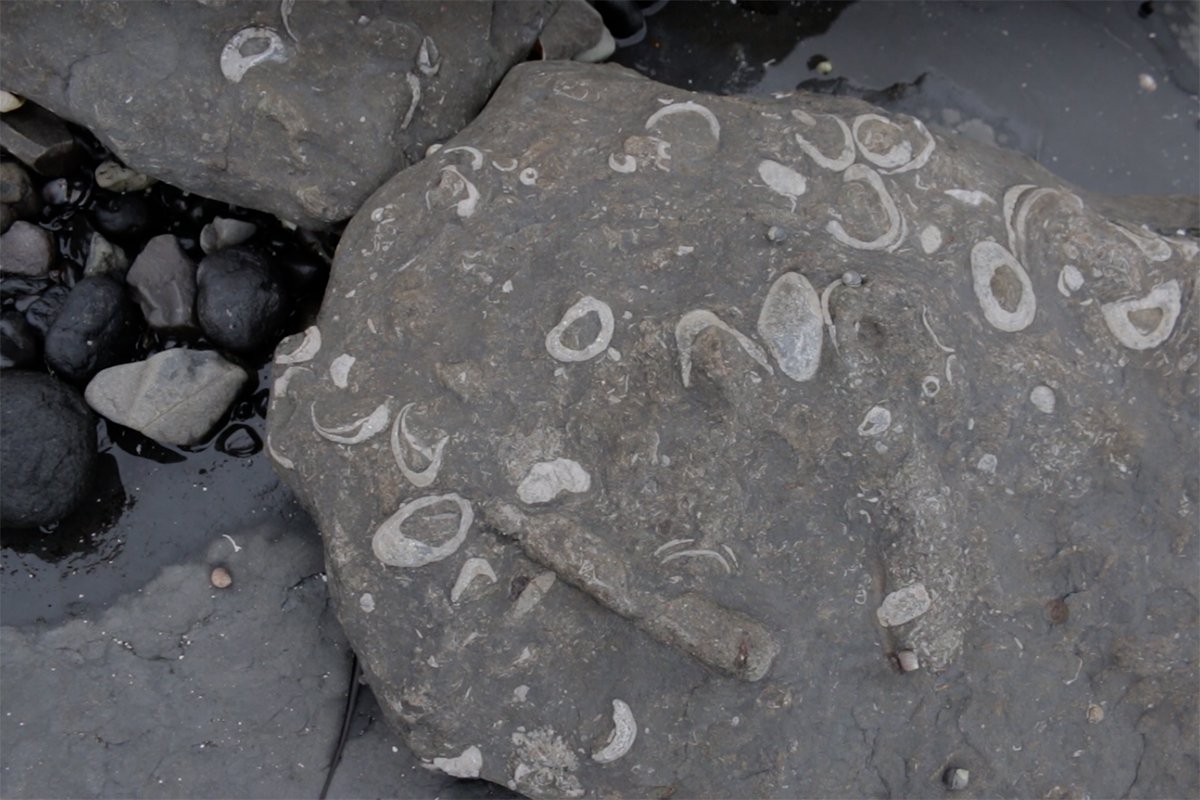
The casts of long-extinct ammonites are spotted along the shoreline in the shale. Igneous sills also intrude across the shale rock along the coast here, with a particularly remarkable sill cutting across in a dyke formation with cooling cracks that create a repeating square pattern across the rock.
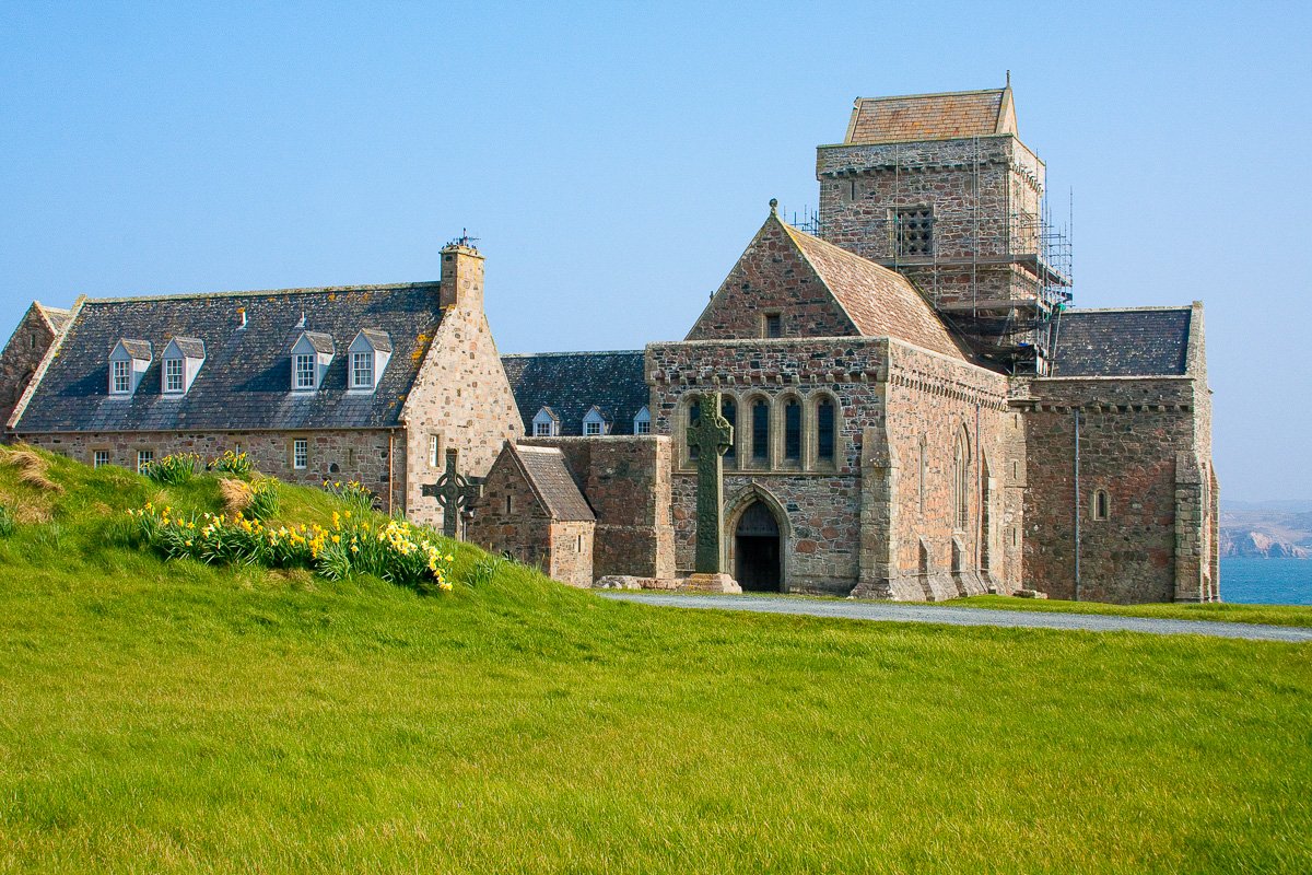
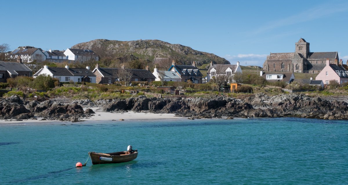
Iona Abbey
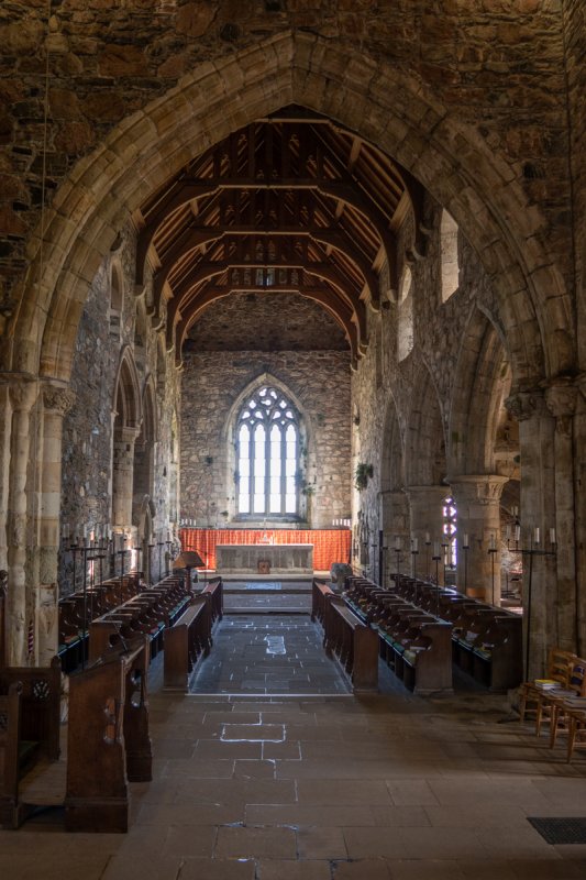
The island of Iona lies off Mull’s south western tip with a CalMac passenger ferry delivering visitors across. Although small in size at three miles in length, Iona occupies a significant place in history, in particular in the spread of Christianity, and is visited by people from all around the world who come to see Iona’s Benedictine Abbey, which dates back to the Middle Ages.
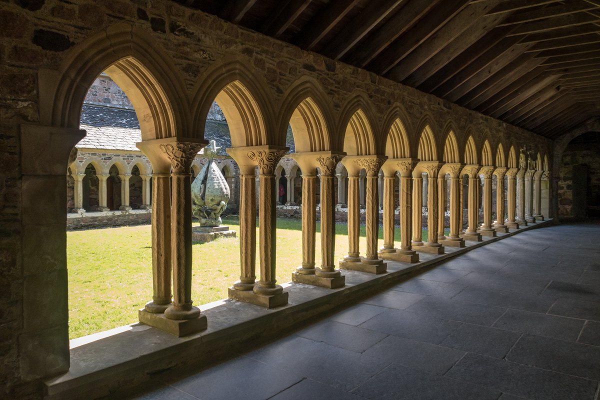
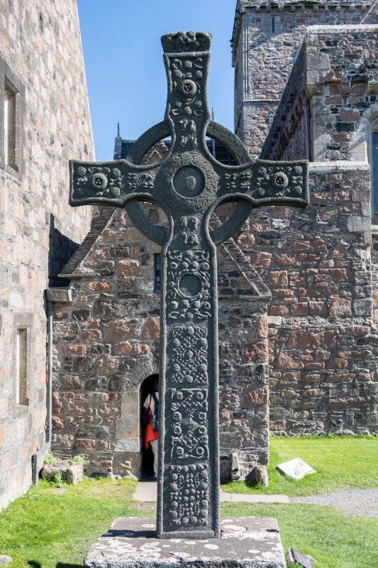
St Columba arrived on the island in 563 AD, bringing the gospel with him. Here, he founded a monastery and built Columba’s church. Following turbulent times of Viking raids for several centuries, in the 13th century, the abbey was built in its place and little remains of the original church today, but the abbey has been very well preserved. The stunning cloisters at its centre, looking onto a central grass courtyard area, with carved stone columns are particularly atmospheric and a museum offers a more detailed inspection of some of the abbey's artefacts and notable history.
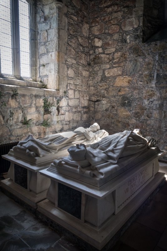
In the abbey’s grounds lies St Oran’s Chapel and as visitors make their way from Baile Mor, Iona’s village, to the Abbey, they will pass the Augustinian Nunnery and graveyard too, where many clan chiefs were laid to rest.
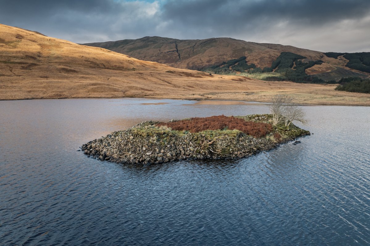
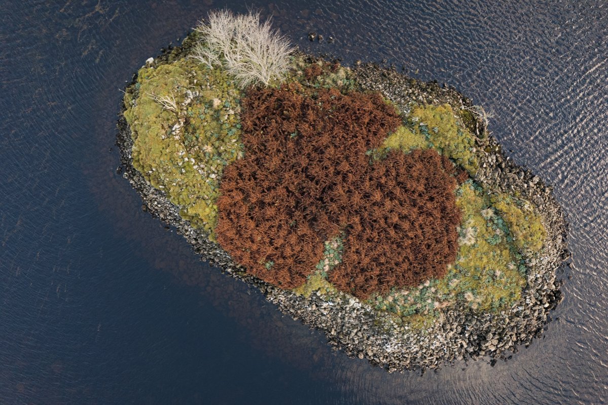
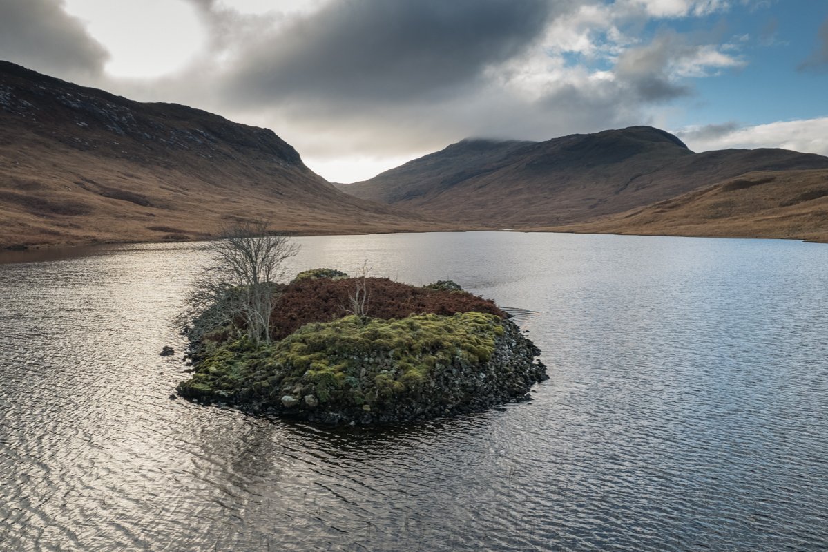
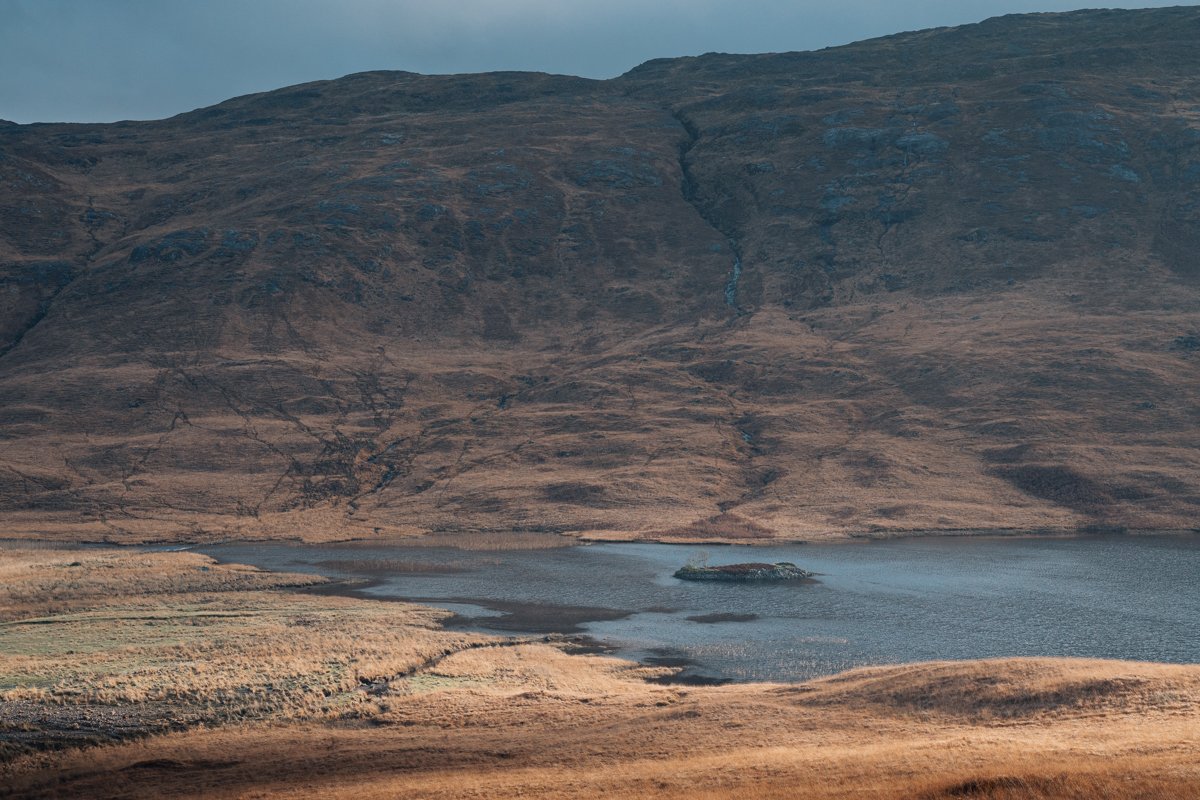
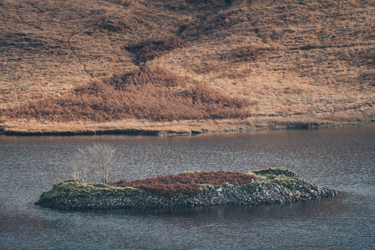
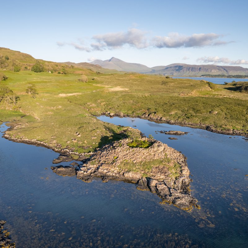
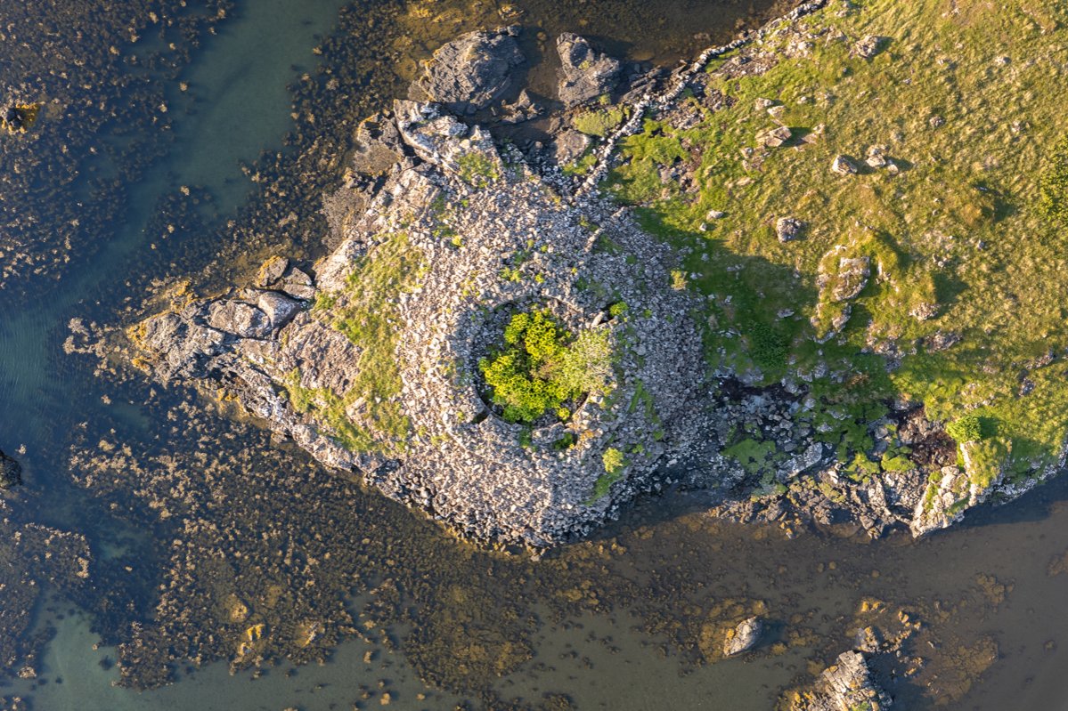
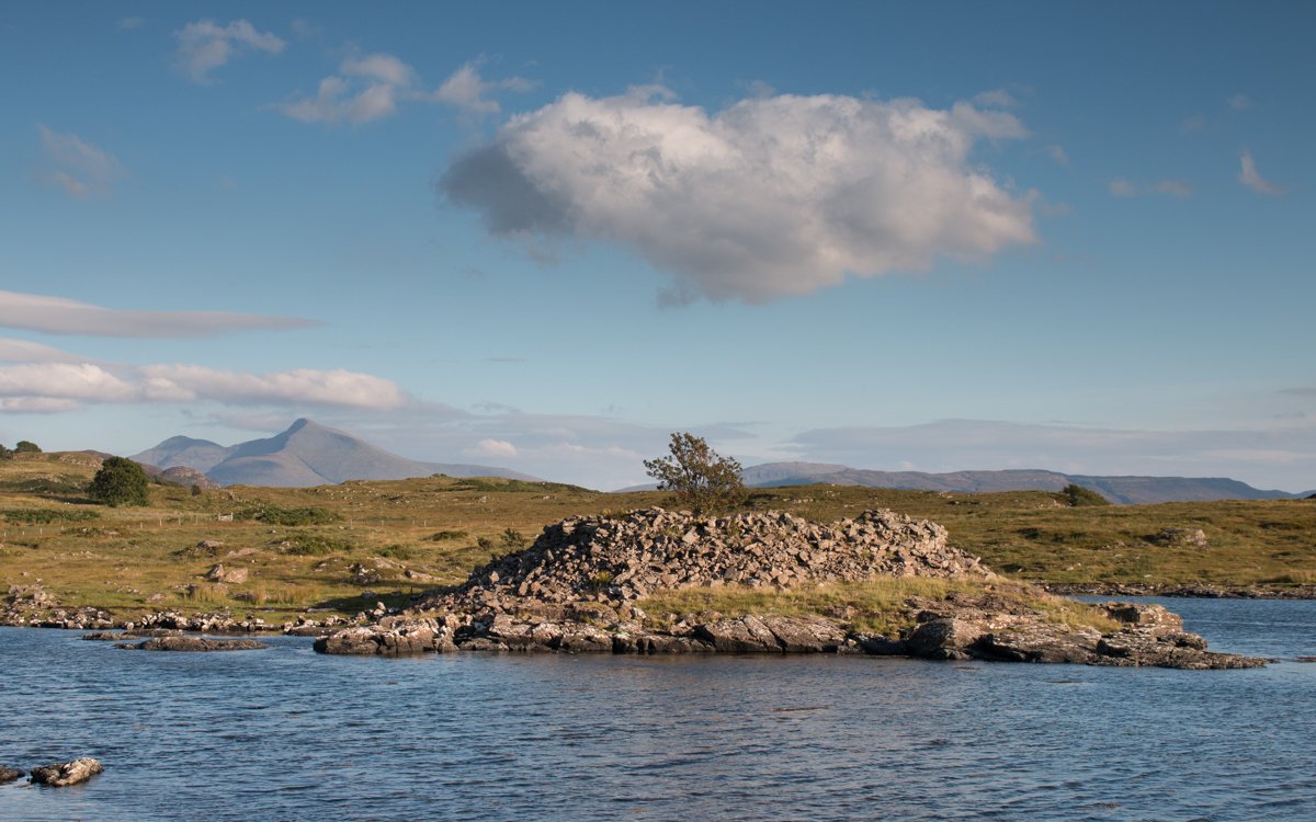
Crannogs
Manmade islands may not be the first thing you’d expect to see as you venture around Mull, but crannogs do appear in the landscape, with perhaps one of the most notable being the crannog in Loch Sguabain as you journey through the mountains of Glen More.
This believed to be artificial island is encircled with a substantial dry stone wall and, while little evidence remains to tell its tale, it is believed that the crannog would have once contained small buildings and was linked to the Macleans of Lochbuie in the 16th century.